An earthquake of magnitude 3.2 occurred on March 15, the epicenter of the earthquake was concentrated on land approximately 21 km from Garut district, the earthquake center was at a depth of 17 km. The second earthquake of magnitude 3.6 occurred on March 15 at 23:53 West Indonesia time, the epicenter of the earthquake was 17 km from Bandung. Strong undersea earthquakes have rocked western Indonesia and the Philippines capital region.
According to the US Geological Survey, the strength of the underwater earthquake was 6.7 points, the depth of the source was 16 km. There were no reports of major damage or tsunami warnings.
The offshore earthquake was caused by movement along the Manila Trench and its epicenter was about 110 km west of Lubang Island in Occidental Mindoro province, which is south of Manila. Indonesia and the Philippines lie along the Pacific “Ring of Fire” – seismic faults around the Pacific Ocean where most of the world’s earthquakes and volcanic eruptions occur.
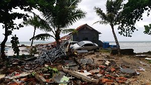
Earlier, a magnitude 6.2 earthquake in Indonesia’s West Sumatra province last month killed at least 16 people and injured more than 400. Thousands of homes and other buildings were damaged by the tremors, which were felt as far away as Malaysia and Singapore.