Leaks of methane and carbon dioxide from the ocean floor, from cracks in the ground, industrial leaks and emissions from tropical forests have been detected.
Christian Berndt, a professor at the Helmholtz Center for Ocean Research in Kiel (Germany), and his colleagues immediately discovered 23 giant craters in the photographs, which, as their calculations show, arose as a result of the destabilization of methane hydrate deposits hidden at the bottom of the Atlantic under permafrost that formed in the sea. soil during the glaciation era. They came to this conclusion by analyzing seismic data that was obtained while studying the structure of the Atlantic Ocean floor about 100 kilometers west of the coast of Mauritania.
Using tremors, scientists reconstructed and studied in detail the three-dimensional shape of the bottom surface in this region of the Atlantic, which is submerged to a depth of approximately 400–1.9 thousand meters from the ocean surface.
These frozen reserves of natural gas remained stable until recently, but rising temperatures on Earth have caused them to begin to break down and be released explosively. In the past, climatologists and oceanographers believed that such processes occur only in relatively shallow regions of the World Ocean off the coast of the Arctic, where large reserves of methane hydrates are also concentrated. Their destabilization in the Russian and foreign Arctic has already led to the formation of a large number of craters at the bottom of the Arctic Ocean and to the release of large volumes of methane.
The discovery of such structures at great depths off the coast of North Africa, the researchers note, suggests that there are significantly more unstable marine deposits of methane hydrates on Earth than scientists previously thought.
The next sources of greenhouse gases are cracks in the ground. In 2011, scientists discovered an underground cave based on a characteristic feature – birds flying past fell dead. It turned out that deep underground there are cracks from which carbon dioxide of volcanic origin oozes. Inside the cave there is a stable microclimate, there is no air movement, so gas has been accumulating in it for many millennia. The highest concentration of gas, more than 50%, is observed at dawn, then it is heated by the sun and dissipates during the day. The key point is the thickness of the layer – already at a height of 10 cm from the ground the concentration drops below 35%, and at a height of 40 cm it reaches completely safe parameters.
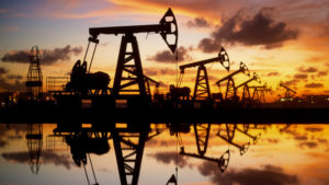
Also, between 8 and 12 percent of methane emissions from the oil and gas sector each year, or eight million tons, occur where oil and gas are produced and transported.
Methane is the second most important greenhouse gas after carbon dioxide: its emission level is much lower, but its potential for impact on global warming is 28-34 times higher. The 21st century has seen a steady increase in methane emissions into the atmosphere, with emissions likely to increase by 80 percent by the end of the century due to the impact of global warming on wetland ecosystems. In recent years alone, methane emissions from the oil and gas sector have increased from 65 to 80 million tons per year. This increase is partly due to increased shale gas production in the United States, China, Africa and South America, but its sources are not fully identified.
Presumably, some of the unaccounted emissions may come from ultra-emitters—points of intense (more than 25 kilograms per hour) emissions that accompany oil and gas production.
Tropical forests are critical to Earth’s climate system, but understanding exactly how much carbon they absorb, store and release from the atmosphere is difficult to quantify, not least because measurement and reporting methods vary. A study published recently in the journal Carbon Balance and Management explains why there may be a gap between carbon flux estimates based on Earth observation satellite data and countries’ estimates reported in National Greenhouse Gas Inventories.
Satellites provide independent information showing how forests are changing over time, allowing estimates of carbon flow rates. These measurements can then be compared with results reported in National Greenhouse Gas Inventories. The published paper cites the example of Brazil, where estimates using Earth observation data showed that the country as a whole was a net carbon sink between 2001 and 2020. This contrasts with the country’s inventory, which found that human activities have caused Brazil’s forests to become a net source of carbon.
A carbon source emits more carbon than it absorbs through activities such as deforestation, logging, and fires. A carbon sink, on the other hand, is a reservoir that absorbs more carbon from the atmosphere than it emits due to the continued growth of existing forests and the regeneration of new forests.