El Niño and La Niña are opposing phases of the Southern Oscillation (ENSO), one of the most powerful drivers of interannual climate variability. These are naturally occurring climate phenomena characterized by increased sea surface temperatures in the central and eastern equatorial Pacific Ocean. El Niño events typically occur every 2 to 7 years and last for 9 to 12 months. They often begin to form between March and June, reach their peak intensity between November and February, and have the strongest impact on global temperatures for the year following their onset.
In November 2025, NASA and its European partners launched the Sentinel-6B satellite to improve hurricane forecasts, protect infrastructure, and boost commercial operations, including shipping. Currently, this satellite lags its predecessor, Sentinel-6 Michael Freilich, by 30 seconds. Both satellites provide precise sea level measurements during what oceanographers predict will be a historic El Niño event—a natural ocean phenomenon in which warmer-than-normal Pacific waters alter global weather patterns.
The two satellites make up the Copernicus Sentinel-6/Jason-CS (Continuity of Service) mission, the latest in a series of ocean-observing radar altimetry missions that have continuously monitored changes in Earth’s maritime regions since the early 1990s.
The data collected by each satellite will not only allow scientists to better understand this year’s El Niño phenomenon, but will also help them make more accurate hurricane forecasts.
“This El Niño event is a late bloomer,” said Josh Willis, the Sentinel-6B project scientist at NASA’s Jet Propulsion Laboratory in Southern California. “It only started mid-year and is only now reaching a strength comparable to what we saw during the significant El Niño events of 1997 and 2015, which were recorded by satellites. We expect it to be significant, and it is already having a significant impact.”
El Niño typically disrupts weather patterns associated with precipitation and storms, including hurricanes. It also redistributes heat within the ocean, which affects sea levels. Typically, the warmest ocean waters on Earth are located along the equator in the western Pacific. During El Niño, a weakening of the winds that typically blow westward along the equator causes warmth to spread eastward, toward South America. This change in ocean temperature shifts hurricane activity from the Atlantic to the Pacific.
On July 15, 2026, the Sentinel-6B satellite began transmitting low-latency data to scientists that can be used for weather forecasting. It will take some time for this data to be integrated into the research models that meteorologists and climate scientists rely on, but when it does, improved models could save lives.
Data from the Sentinel-6 satellite is used in hurricane tracking algorithms. These forecasts can catalyze disaster response efforts and lead to evacuation orders, requiring rapid but informed logistical decisions at the local level.
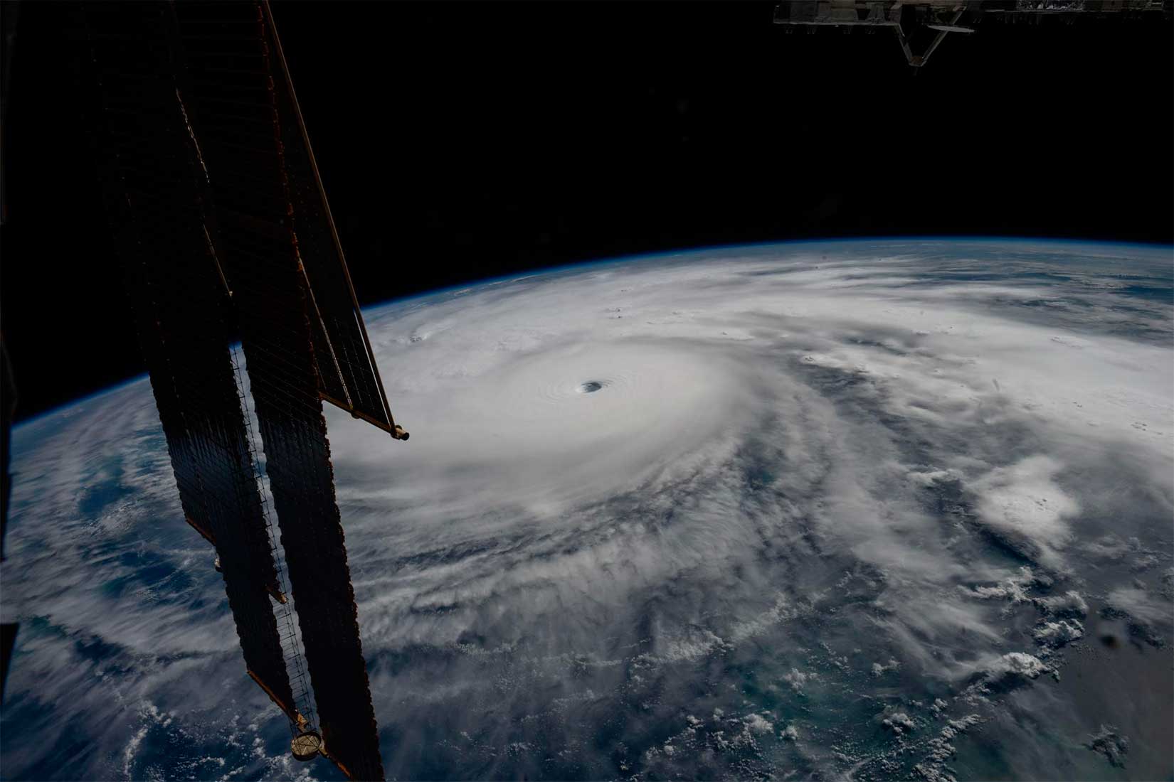
In this image taken from the International Space Station on October 28, 2025, Hurricane Melissa is visible 80 kilometers south of Jamaica. NASA
It can take a week or more for a tropical storm to strengthen into a hurricane and make landfall, but a hurricane can quickly intensify within 48 hours of making landfall, leaving planners little time to prepare.
“Hurricanes are known to intensify rapidly at the last minute, so there’s very little time to make decisions,” said Deirdre Byrne, an oceanographer and altimeter with the National Oceanic and Atmospheric Administration (NOAA). “The goal is to predict how strong and how quickly a hurricane will intensify so officials can make the right decisions.”
Bern oversees one of the country’s most important hurricane forecasting algorithms—a suite of ocean heat content algorithms based on NOAA satellite data—that has been in operation since 2012.
Each Sentinel-6 satellite measures ocean height, as well as wave size and offshore wind speed, using a radar altimeter, which sends thousands of radar pulses per second to wave crests and troughs. Ocean height varies from location to location and allows for an estimate of ocean heat content, as warm water expands. This, in turn, helps predict the speed of hurricane development.
Each satellite carries a second instrument, called the Global Navigation Satellite System – Radio Occultation (GNSS-RO), which measures atmospheric properties such as humidity, pressure, and temperature.
Among the data collected by Sentinel-6, Byrne is most looking forward to receiving ocean height information, which she plans to begin incorporating into the current Satellite Ocean Heat Content Suite algorithm by the end of the year.
“In terms of data quality, the Sentinel-6 missions are unrivaled,” Byrne said.
Together, these missions also expand the accurate data base that has existed for over four decades. This history of sea level observations dates back to the TOPEX/Poseidon mission, launched in 1992, and continues today with the Sentinel-6 Michael Freilich satellite. Sentinel-6B will replace its predecessor as the reference satellite for global sea level measurements later this year.
“The key is consistency, measuring with the same method every time,” said Séverine Fournier, deputy project scientist for Sentinel-6B at the Jet Propulsion Laboratory (JPL). “This is what allows us to predict hurricanes and, in turn, protect coastal communities and infrastructure.”
Sentinel-6 Michael Freilich, named after the former director of NASA’s Earth Science Division, is one of two satellites that make up the Copernicus Sentinel-6/Jason-CS mission. Part of the European Union’s Earth observation program, Copernicus, Sentinel-6/Jason-CS was developed jointly by ESA (the European Space Agency), EUMETSAT (the European Organisation for the Exploitation of Meteorological Satellites), NASA, and NOAA, with funding from the European Commission and technical support from the French space agency, CNES (the Centre National d’Etudes Spatiales). EUMETSAT monitors and controls the spacecraft, as well as processes all altimeter scientific data, on behalf of the European Union’s Copernicus program, with the support of all partner agencies.
NASA’s Jet Propulsion Laboratory (JPL), a division of the California Institute of Technology in Pasadena, provided three science instruments for each Sentinel-6 satellite: the Advanced Microwave Radiometer, GNSS-RO, and the Laser Retroreflector.
NOAA’s Climate Prediction Center expects the current El Niño to continue strengthening through the end of 2026, with a 97 percent chance of persisting until early spring 2027 in the Northern Hemisphere. Even in the early stages of El Niño, satellites recorded characteristic changes along the equatorial Pacific Ocean, such as warmer-than-normal sea surface temperatures and higher-than-normal sea levels.
As of June 2026, El Niño has officially arrived. This naturally occurring, recurring phenomenon is characterized by warmer-than-normal sea temperatures in parts of the equatorial Pacific Ocean, as well as changes in atmospheric and oceanic circulation. Its regional impacts range from desert flooding to delayed monsoons and a shift in the locations where tropical cyclones are more likely to form.
The first environmental impacts include changes in the marine food chain. Concentrations of chlorophyll-a, a pigment present in most phytoplankton, were measured by the Ocean Color Instrument (OCI) on NASA’s PACE (Plankton, Aerosol, Cloud, Ocean Ecosystem) satellite. In June 2025 (left), conditions were neutral, while in June 2026 (right), El Niño was strengthening, NASA’s press service reports.
The most noticeable change is observed in the central Pacific Ocean, near the equator north of New Zealand: the concentration of chlorophyll, an indicator of phytoplankton abundance, is significantly lower in 2026. This change is expected, said Matthew Curley and Graham Trolli, oceanographers at the Ocean Ecology Laboratory at NASA’s Goddard Space Flight Center. This is because during El Niño, the easterly equatorial trade winds weaken, the warm surface layer of the ocean deepens, and the upwelling of cold, nutrient-rich water that typically fuels phytoplankton growth is suppressed.
As the El Niño event develops, scientists predict that differences in the central Pacific will become more pronounced. “This could manifest itself as greater differences within the current region, an expanded area of decreased chlorophyll-a concentration at the surface, or both, depending on the behavior of the equatorial trade winds,” they stated.
The decline in phytoplankton abundance has a ripple effect throughout the marine food chain, including in coastal areas. Less food is available for zooplankton, as well as fish, seabirds, and marine mammals. Peru’s anchovy fishery experienced sharp declines in catches during past El Niños, also caused by warmer surface waters, reduced upwelling, and reduced phytoplankton abundance. In 2026, Peru’s Ministry of Production repeatedly suspended the fishery to protect the country’s primary fishery resource. Pelicans have been spotted foraging in Peruvian ports and urban areas.
Although disruptions to marine life can be severe, an El Niño can be followed by a “chlorophyll recovery,” with chlorophyll concentrations in the equatorial Pacific rising to above-normal levels. Research suggests that higher iron concentrations carried by ocean currents, as well as dust from drier areas of Central and South America, contribute to this recovery—a recovery that does not require a subsequent La Niña event. La Niñas, which often follow El Niño events, can also lead to increased chlorophyll concentrations. A strong La Niña event in 1998–1999 caused massive phytoplankton blooms in the eastern Pacific and a sharp increase in fish populations.
Scientists now have new tools to study this kind of variability. The PACE mission launched in February 2024, making this the first full El Niño event for which the satellite will collect global hyperspectral data almost daily. “The scientific community will be able to observe the 2026 El Niño using data across a wider range of wavelengths than ever before,” stated Kerley and Trolli.
To better understand the impact of El Niño on ocean life, researchers hope to use PACE data to assess the response of specific phytoplankton communities to this event. As the scientists note, PACE’s capabilities extend beyond the marine environment. PACE sensors can measure the composition of plant pigments on land, as well as in clouds and atmospheric aerosols affected by El Niño.
The El Niño phenomenon, characterized by warmer-than-normal sea temperatures in parts of the equatorial Pacific Ocean, returned in June 2026. Sea surface height observations by the Sentinel-6 Michael Freilich satellite showed that the 2026 event continued to strengthen.
This naturally occurring, recurring phenomenon can have widespread impacts, typically resulting in increased rainfall in the southwestern United States and drought in western Pacific countries such as Indonesia and Australia. On June 11, NOAA declared an El Niño after sea surface temperatures in the central and eastern equatorial Pacific Ocean were at least 0.5 degrees Celsius above average for several consecutive months.
Meanwhile, NASA scientists are observing another sign of El Niño: zones of elevated sea surface heights. When ocean water warms, it expands in volume and causes sea level rise, making sea surface heights a reliable indicator of ocean temperature. Higher-than-normal temperatures, and consequently higher sea surface heights, in some parts of the equatorial Pacific Ocean are associated with El Niño.
The map shows sea surface height anomalies in the central and eastern Pacific Ocean recorded on June 8, 2026. Above-average sea levels are shown in red. Normal sea levels are shown in white, and lower sea levels are shown in blue.
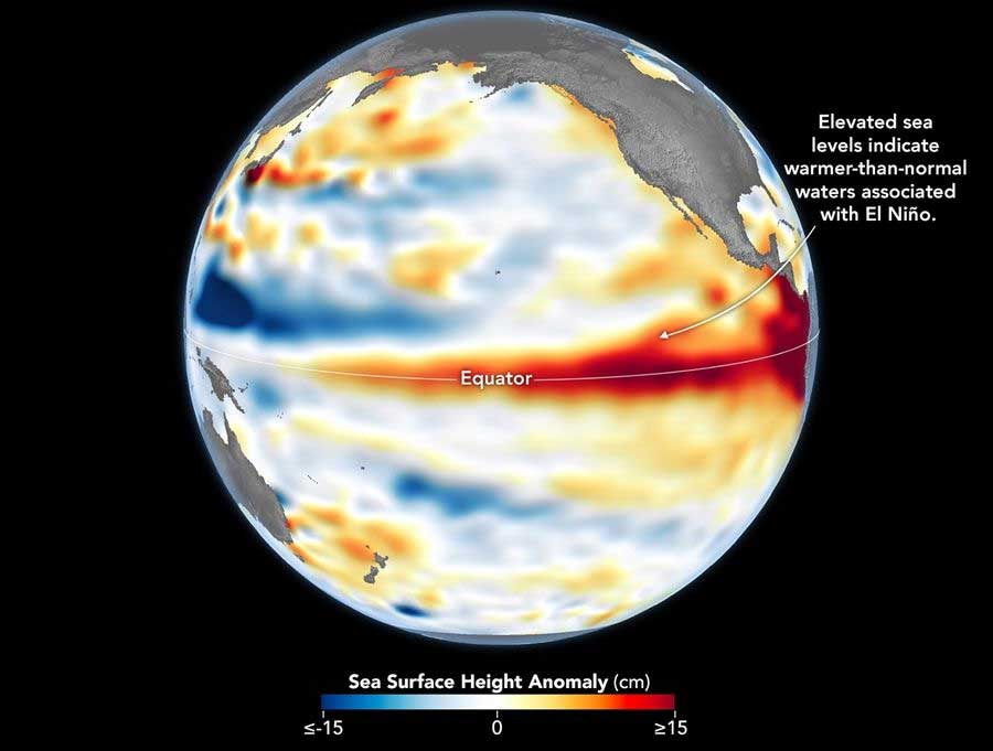
This map, taken on June 8, 2026, in the central and eastern Pacific Ocean, a few days before the El Niño event was declared, shows areas of sea level higher than normal (in red). Data for the map was acquired by the Sentinel-6 satellite (Michael Freilich) and processed by scientists at NASA’s Jet Propulsion Laboratory (JPL). NASA Earth Observatory/Lauren Dauphin
The data for the map was acquired from the Sentinel-6 Michael Freilich satellite, launched in 2020 by NASA under the leadership of ESA (the European Space Agency), and processed by scientists at NASA’s Jet Propulsion Laboratory (JPL). It should be noted that signals associated with seasonal cycles and long-term trends were removed to highlight sea level anomalies associated with El Niño and other short-term natural phenomena.
In the spring of 2026, the satellite began detecting El Niño precursors, when waves of warm water hundreds of kilometers wide, known as Kelvin waves, moved from the western Pacific to the eastern Pacific. This occurs when trade winds in the western equatorial Pacific weaken and then temporarily reverse to the west. The warm water accumulates in the east, deepening the warm surface layer, lowering the thermocline, and suppressing the upwelling that typically maintains cooler water temperatures along the Pacific coast of the Americas.
The accumulation of heat beneath the water’s surface is what sea level observations record. These data go beyond surface temperature measurements and reveal how much heat is stored in the subsurface layer. This is important because a shallow warm layer may not have a significant impact on climate and weather, while a large amount of heat stored beneath the surface can be more significant.
El Niño, and its counterpart La Niña, can significantly intensify weather events around the world, worsening extreme events—from heat waves and droughts to heavy rains, flooding, and disrupted winter storm tracks—all on top of the effects of already existing human-caused climate warming.
The interconnected ocean-atmosphere system, which includes the El Niño and La Niña phenomena, known as the El Niño-Southern Oscillation, is responsible for significant variations in global temperature and precipitation, the ESA press service reports.
The El Niño phenomenon occurs every few years when the trade winds weaken, allowing warm surface waters in the western Pacific to shift eastward.
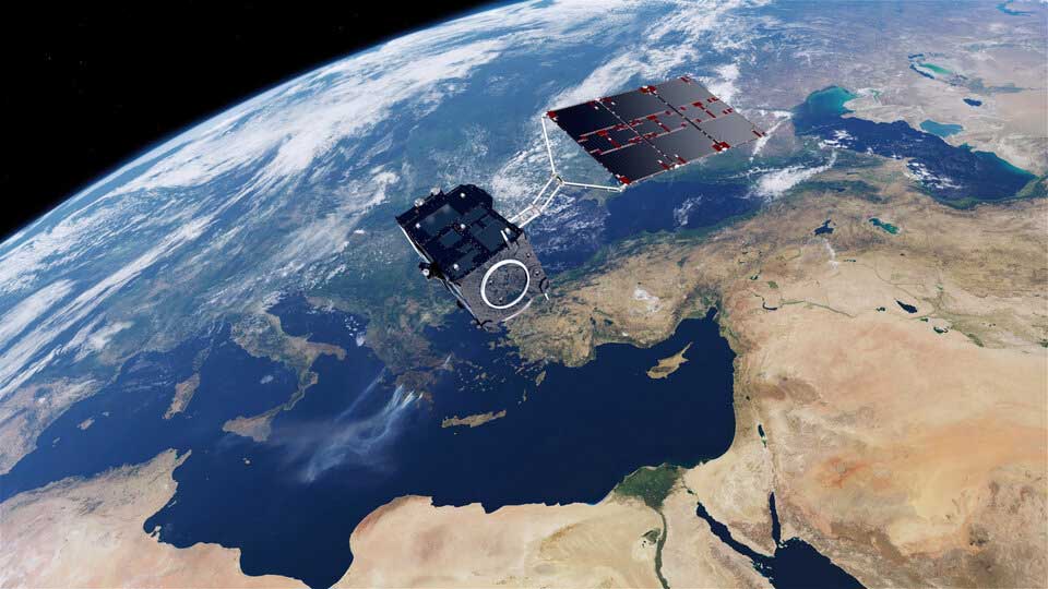
Sentinel-3 satellite identifies hotter regions. ESA
Changing ocean temperatures alter wind patterns and atmospheric circulation, causing a cascade of effects that can affect weather around the world.
El Niño events often begin quietly, with unusually warm surface waters in the tropical Pacific Ocean—exactly the conditions we’re seeing now.
The animation below illustrates the early signs of this developing phenomenon, showing sea surface temperature anomalies for the period June 1–7, 2026, compared to the average for the same period in 1991–2020.
ESA’s Craig Donlon explained: “We use anomalies—the difference between current conditions and the long-term average—because El Niño events often begin as minor deviations from what’s considered normal, and these early changes are easier to spot against a reference model. While the temperature difference may seem small, the ocean stores and exchanges enormous amounts of heat, so even small warming can indicate very large changes in the energy flow between the ocean and the atmosphere.”
Sea surface temperature. ESA
Additional warmth can enhance updrafts and precipitation over the tropical Pacific Ocean, as well as alter atmospheric circulation well beyond the tropics. In some cases, these changes can generate large-scale atmospheric waves propagating toward higher latitudes and upward into the stratosphere. Under certain conditions, this could increase the likelihood of a weakening of the polar vortex or disruption of the circulation pattern of European winter climate.
If such a disruption occurs, its effects can sometimes extend downward into the lower atmosphere over the following weeks, affecting the jet stream and the likelihood of persistent weather patterns over parts of the North Atlantic and Europe. This doesn’t mean El Niño directly causes cold winters in Europe, but it can alter the likelihood of certain winter conditions, especially when combined with other factors, such as the quasi-biennial oscillation, which also influences how easily the polar vortex is disrupted.
Scientists monitor these changing conditions using satellites, weather balloons, and computer models. No single observation can determine the course of winter, but the combination of these sources helps forecasters assess whether the atmosphere is becoming more susceptible to large-scale circulation changes.
El Niño is one of the phases of the El Niño-Southern Oscillation. After this, conditions sometimes shift toward La Niña, but not always, and the timing and intensity of this transition varies from event to event.
Sea surface temperature measurements from satellite missions such as Copernicus Sentinel-3 are key to monitoring changes in sea surface temperature. Its Sea and Land Surface Temperature Radiometer (SST) measures global sea surface temperature and land surface temperature daily with an accuracy of better than 0.3 K, providing critical data for monitoring changes in ocean conditions.
Sea surface temperature anomaly. ESA
As seawater warms, it also expands, contributing to sea level change. Here, measurements from the Copernicus Sentinel-3 synthetic aperture radar altimeter provide key information.
The Copernicus Sentinel-6 mission (the reference mission for satellite altimetry), complemented by two altimeters on the current Sentinel-3 satellites, provides Europe with unique information on sea level and sea level anomalies.
Satellite measurements obtained by the Infrared Atmospheric Sounding Interferometer on the MetOp meteorological satellites and the recently launched MetOp-Second-Generation-A1 satellite are useful for studying the quasi-biennial oscillations.
The intensity of the El Niño climate phenomenon in the Pacific Ocean, which affects the entire planet’s climate, has increased by 40% over the past 40 years and reached its peak for the current millennium. Increased fluctuations will increase the frequency of severe floods and droughts, according to the University of Michigan press service.
El Niño is one of the main drivers of extreme weather events. Therefore, if it intensifies, the impacts of these climate anomalies will be even more pronounced. The associated changes in the Earth’s hydrological cycle will lead to even greater damage to infrastructure and new epidemics of cholera and other diseases.
As scientists explain, Earth’s weather and climate are largely determined by various major periodic phenomena, in which air and water temperatures, as well as the nature of atmospheric currents and air flows, constantly “switch” between several states. The most famous example of this is the El Niño phenomenon, during which the surface temperature of the equatorial Pacific Ocean rises anomalously every 3–5 years.
Scientists have long been interested in how global warming will affect El Niño, but obtaining this information has been hampered in the past by the fact that observations of this climate phenomenon have only been conducted since the 1980s. To fill this gap, university researchers studied 13 coral reefs that formed off the coasts of five different Galapagos Islands over the past millennium.
As scientists explain, water temperature has a strong influence on the amount of heavy oxygen-18 contained in the calcareous shells of corals and also determines the ratio of calcium and strontium atoms. This allows for highly accurate calculations of seasonal fluctuations in sea surface temperatures by tracking how these paleochemical indicators change in different layers of fossilized corals.
The measurements showed that high-intensity El Niños have only occurred in the last 40–50 years, while they were consistently weak in the pre-industrial era. The scientists also found that the severity of El Niño events over the millennium has been highly dependent on average global temperatures. This suggests that further temperature increases will further strengthen El Niño events, which will also impact the extreme weather events associated with them, the climatologists concluded.
El Niño continues to strengthen and by the end of 2026 could surpass all previous El Niño events since 1950. The probability of such an event occurring in October–December is 75%, according to a forecast from the NOAA Climate Prediction Center published on September 10, 2026. The probability of a very strong El Niño in the fall and winter of 2026–2027 exceeds 90%.
El Niño is a warm phase of the natural climate cycle in the tropical Pacific Ocean. During this phase, trade winds weaken, and warm water shifts eastward, toward the American coast. This alters atmospheric circulation and precipitation distribution far beyond the ocean. The phenomenon affects weather, natural ecosystems, and economic activity.
Observations are already recording further ocean warming. In August, sea surface temperatures in the key region of Niño-3.4 were 1.8°C above normal, while in the eastern region of Niño-1+2, they were 3.4°C above normal. Enhanced precipitation persisted in the central and eastern equatorial Pacific, while precipitation was suppressed over Indonesia.
To estimate a potential record, experts use the relative oceanic index (RONI). It takes into account not only the temperature in the equatorial Pacific Ocean but also the overall temperature of tropical waters. This allows them to assess the severity of the event itself against the backdrop of ocean warming.
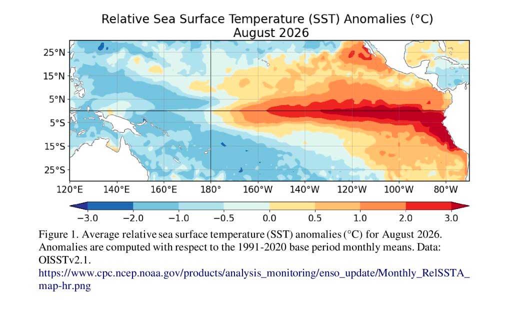
NOAA / Climate Prediction Center
The effects of El Niño vary by region. For example, the southern United States typically receives more rainfall in winter, while the north and parts of Canada experience warmer and drier weather. Off the Pacific coast of the United States, the upwelling of nutrient-rich deep waters weakens, affecting marine food chains.
For Russia, the impacts of El Niño could vary significantly. Researchers at the Institute of Applied Physics of the Russian Academy of Sciences previously identified a link between this phenomenon and decreased winter precipitation in the Far East and increased precipitation along the Black Sea coast. The study was based on modeling and data from 518 Russian weather stations spanning 30 years. However, these patterns do not allow for an accurate prediction of the coming winter’s weather. The September NOAA report did not include a specific forecast for Russia. A high probability of a strong El Niño does not, in itself, mean that Russian regions will face record-breaking frosts, snowfalls, or drought.
The forecast center itself emphasizes that a strong El Niño increases the likelihood of characteristic weather impacts, but does not guarantee them in every region. The next forecast update is scheduled for October 8.
In June 2026, the Food and Agriculture Organization of the United Nations (FAO) and the World Food Programme (WFP) launched their first joint appeal for funding to address the expected intensification of the El Niño climate phenomenon. The international organizations hope to raise $202 million to protect the most vulnerable communities from the impacts of extreme weather.
Experts estimate that El Niño could intensify in the second half of 2026, leading to droughts in some regions and increased risk of floods and storms in others. The greatest threat is predicted for several countries in Africa, Asia, the Pacific, Latin America, and the Caribbean.
There are 22 countries at high risk, including Ethiopia, Kenya, Somalia, Sudan, Uganda, Zimbabwe, Afghanistan, Pakistan, the Philippines, East Timor, Colombia, Guatemala, Haiti, Honduras and Venezuela.
According to international organizations, approximately 1.2 million people can already receive support through existing programs. Additional funding will expand assistance to an additional 7.6 million people, bringing the total coverage to 8.8 million residents of the most vulnerable regions.
The program’s core idea is to act before a crisis, not after. FAO and WFP note that every dollar invested in preventive measures can prevent up to seven dollars in future losses and emergency response costs.
Planned activities include cash assistance to the population, the supply of drought-resistant and flood-resistant seeds, support for livestock farming, the creation of water storage systems, the construction of flood protection infrastructure, and the dissemination of forecasts and warnings about adverse weather events.
The UN emphasizes that the current forecast coincides with a period when millions of people are already facing food insecurity caused by armed conflicts, economic instability, forced population displacement, and the consequences of previous climate disasters.
During the previous El Niño cycle in 2023–2024, FAO and WFP were able to provide advance assistance to over 3 million people. Now, the international organizations intend to significantly scale up such efforts, hoping to reduce the risk of food crises and preserve the livelihoods of millions of families.
A strengthening El Niño could lead to new temperature records and significantly alter precipitation patterns across different regions of the world. UN Secretary-General António Guterres warned that the natural phenomenon is developing against a backdrop of already high global temperatures and could further intensify extreme weather.
“Two months ago, I warned that El Niño was at our doorstep. Now it’s already inside, raising temperatures,” Guterres said in New York on July 31.
El Niño is a periodic warming of sea surface temperatures in the central and eastern equatorial Pacific Ocean. It influences atmospheric circulation and can alter precipitation and temperature patterns far beyond the region itself—from South Asia and Australia to Africa, Europe, and the Americas.
The World Meteorological Organization reports that El Niño has already formed and is rapidly strengthening. Sea temperatures in the key observation area are approximately 3°C above normal, an unusually high value for the early stages of the event. Most forecast models predict that the current episode will become severe, but the WMO does not use the unofficial term “super El Niño.”
According to climate scientists, the Pacific Ocean region used to assess El Niño intensity has been experiencing record-high temperatures for the corresponding stage of its development for 15 weeks. The peak of the phenomenon is expected in late fall or winter, and its influence could persist until the spring of 2027.
The WMO predicts that from August to October, land temperatures will be above normal in almost every region of the planet. At the same time, the likelihood of drought and fires increases in India, Indonesia, Australia, parts of South America, and southern Africa. Increased precipitation is possible in parts of the United States, southern Europe, Central Asia, the Horn of Africa, and southeastern South America.
See also... New method for observing individual atoms confirms century-old quantum mechanical theory |
Of particular concern is India, where the summer monsoon is weaker than usual. The lack of precipitation could impact crops, water supplies, and power generation, while in other regions, changes in circulation could, conversely, lead to heavy rains and flooding.
El Niño itself is a natural climate phenomenon. However, its effects are compounded by long-term warming caused by greenhouse gas emissions. A warmer ocean and atmosphere contain more energy and moisture, so heat waves, intense rainfall, and associated natural disasters can become more severe. However, the WMO emphasizes that there is currently no scientific evidence that climate change is increasing the frequency of El Niño events.
Guterres recalled that the summer of 2026 had already been marked by prolonged heat waves, massive fires in Spain and France, and thousands of additional deaths. He stated that a further strengthening of El Niño could be just the next stage of the current season of climate extremes.
The UN called on states to expand early warning systems, adopt heat-wave action plans, ensure access to cooling, and introduce requirements to protect people working in high temperatures. Special attention should be paid to the design of cities, schools, hospitals, and housing, taking into account the increasing heat load.
The WMO notes that the forecasts give authorities several months to prepare for potential droughts, floods, wildfires, and agricultural disruptions. Specific impacts will vary by region and depend not only on the intensity of El Niño but also on other climate processes.
El Niño is already restricting traffic through the Panama Canal. The Panama Canal Authority has limited the number of daily transits since early September 2026 due to a longer and more severe El Niño season than usual, which is expected to lower water levels in the canal, according to Reuters. The canal is thus retracting its previous statement that it would not restrict vessel transit.
Under the new measures, the canal limited the number of daily passages to 34 vessels starting September 4, and to 32 starting September 15. Until June 2026, the canal handled an average of 35 vessels per day, which met shipping demand and allowed for the passage of approximately 40 vessels per day.
According to the published warning, starting September 4, the capacity of the Neopanamax locks will be limited to nine ships per day, and the capacity of the Panamax locks will be limited to 25 ships per day. Starting September 15, the capacity of the Panamax locks will be reduced to 23 ships per day.
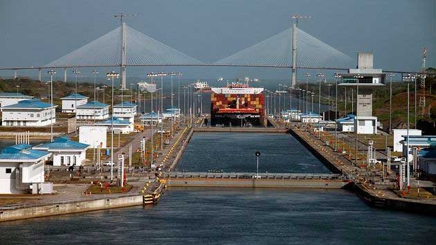
Monica Volpin / Pixabay
The Canal Authority has already tightened vessel draft requirements several times as part of its water resources management strategy. The Authority also reported that rainfall from May to August was 34% below the historical average, and water inflows from catchment areas were 44% below normal. The Authority warned that the expected intensification of the El Niño phenomenon in 2026–2027 could lead to further rainfall reductions, threatening the long-term sustainability of the waterway and local water supplies.
Additionally, the previously planned reduction in the maximum permissible draft for ships has been postponed. The planned reduction to 14.63 meters (48 feet) in the Neopanamax locks was rescheduled for September 2, and the subsequent reduction to 14.48 meters (47.5 feet) was rescheduled for October 1. Draft is the depth at which a vessel can safely float. Reducing the permissible draft means that ships may have to carry less cargo to navigate the canal.
The Panama Canal Authority also said El Niño could last much longer this year than before, requiring the canal to restrict capacity, as it did during the droughts of 2023 and 2024, and impose draft restrictions on ships.
South Korea, which relies almost entirely on grain imports, could face rising prices for noodles, meat, and many other products due to El Niño, Kim Yong-sun, chief environmental expert for the Toburo Democratic Party’s policy committee, told RIA Novosti.
“Imported agricultural commodities that could impact the Korean economy include grain crops such as wheat, corn, and soybeans,” said Kim Yong-sun. He noted that, with the exception of rice, South Korea is almost entirely dependent on foreign supplies of its main grain crops. The country imports approximately 98-99% of its wheat and 96-99% of its corn. The expert noted that self-sufficiency in soybeans is only 6-8%.
The expert explained that this dependence makes the country vulnerable to possible fluctuations in global prices. If El Niño impacts major agricultural-producing countries, the consequences will also impact food prices in Korea. For example, rising wheat prices will impact the cost of instant noodles, bread, and confectionery. Higher prices for corn and soybean meal, in turn, will impact the cost of meat, dairy products, and vegetable oil. The expert added that rising global grain prices will also increase the burden on South Korea’s food service industry, as flour, vegetable oil, sugar, meat, and dairy products account for a significant portion of production costs.
Kim Yong-sun noted that raw sugar, palm oil, coffee, and cocoa are also among the commodities sensitive to El Niño, which creates additional risks for confectionery and beverage producers.
The expert warned that price increases will not reach consumers immediately, but rather through a chain reaction: from global raw material prices to adjustments in retail prices. Large companies will be able to temporarily contain price increases by holding futures and inventories, while small food producers and restaurants lacking such resources will be hit hardest.
El Niño is linked to the devastating floods of 2026 in West African countries. Local authorities attributed the heavy rains to the El Niño climate phenomenon and declared a state of emergency for 60 days, allowing regional authorities to take necessary protective measures in advance and quickly deploy available resources to prevent emergencies.
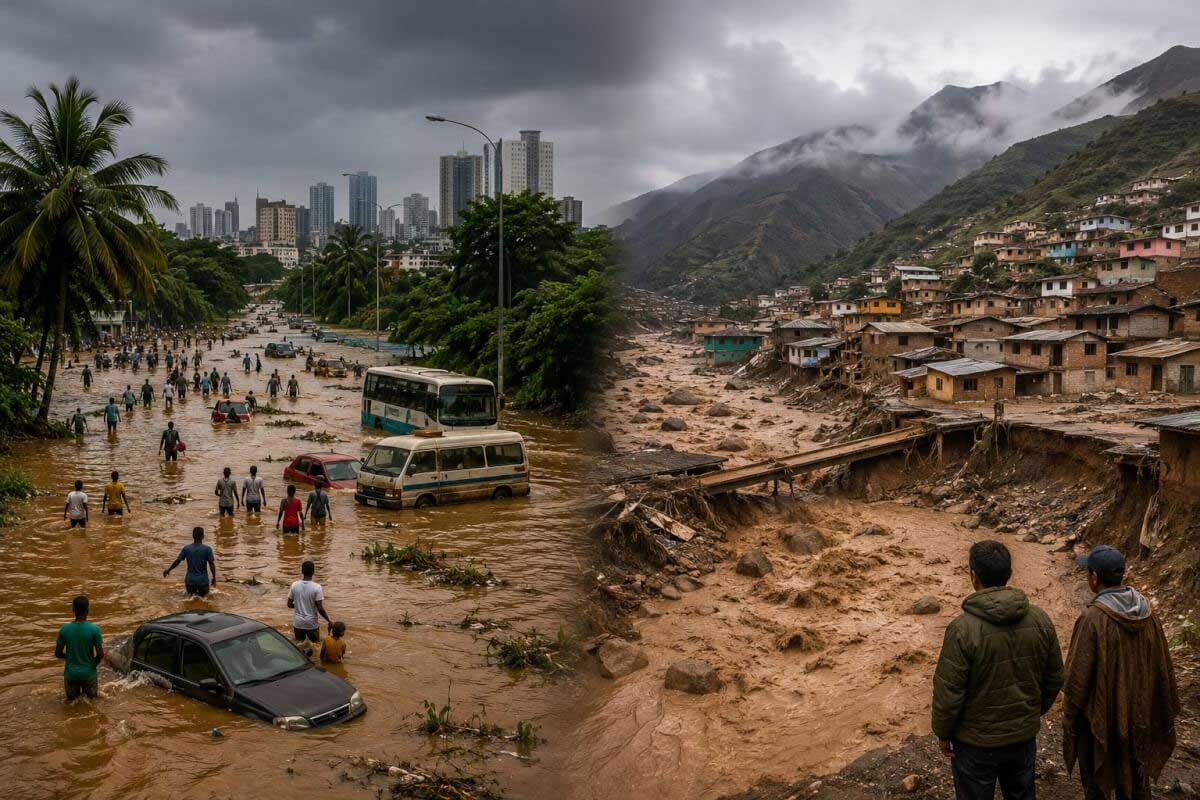
The state of emergency covers areas across the country, including the Lima metropolitan area and the departments of Cusco and Arequipa.
El Niño is a periodic warming of the surface waters of the equatorial Pacific Ocean. This natural phenomenon significantly alters atmospheric circulation and can cause extreme weather events worldwide, including droughts in some regions and record rainfall in others.
Countries in the Asia-Pacific region, Latin America, and Australia risk suffering the most in the event of an El Niño weather event: a climate catastrophe could undermine agricultural production and harvests, Anatoly Tikhonov, director of the Presidential Academy’s Center for International Agribusiness and Food Security, told RIA Novosti.
El Niño is a natural phenomenon that causes the water temperature in the equatorial Pacific Ocean to rise to abnormal levels. This abrupt change in temperature triggers a chain of climate shifts across the planet, with some regions suffering from drought, while others experience flooding.
According to forecasts published by the ECMWF in May, Pacific Ocean temperatures will deviate more than 3°C above normal as early as September-October of this year. This could become the second-highest El Niño peak temperature on record.
“The unprecedented rate of warming in the Pacific Ocean is forcing even skeptics to draw alarming historical parallels. The Asia-Pacific region will face severe moisture shortages. Australia has already begun emergency livestock culling in preparation for a dry spell. Latin America will be in the grip of devastating floods,” the expert commented.
For example, palm oil production in Indonesia could decline by 1–2 million tonnes due to drought and a 30% increase in fertilizer prices. Meanwhile, the US Department of Agriculture’s Foreign Agricultural Service forecasts a 19% decline in Australian wheat production, from 36 million to 29 million tonnes in 2026. As for Latin America, Peru has already declared a state of emergency due to coastal El Niño, resulting in dozens of deaths and hundreds of kilometers of destroyed roads.
These local crises are already impacting global indicators. The FAO Food Price Index rose by 2.3% in April 2026 compared to March, reaching 127.4 points, and experts expect price pressure to further increase as weather risks materialize, Tikhonov concluded.
Since 1950, 27 El Niños have been recorded, with the phenomenon occurring on average every 3–4 years. The most recent occurred between the summer of 2023 and early spring of 2024.
El Niño typically develops in the spring, but in 2026, the situation changed dramatically. As early as mid-March, weekly ocean temperature anomalies were observed below average in the La Niña zone, the opposite of El Niño, and just over two months later, we were already experiencing El Niño.
Ocean temperatures in the El Niño region are at their warmest for early June since at least 1982, according to Climate Central and NOAA.
El Niño is forecast to continue strengthening and become a powerful event. NOAA estimates that the probability of it eventually strengthening into a super El Niño is 63%. This term is used by some meteorologists to describe events with temperatures at least 2°C above average.
Super El Niños of this type are much less common. Since 1950, there have been only five, the last one being 11 years ago, in 2015–16. They also occurred in 1997–98, 1991–92, 1982–83, and 1972–73. Super El Niños were also recorded in 1888–89 and 1877–78.
Some computer forecasting models suggest that the current El Niño could become one of the most intense on record.
One of the consequences that meteorologists are absolutely certain of is the sharp spike in global temperatures during this El Niño. The previous super El Niño broke all global temperature records in 2015 and 2016. Those two years remain among the top 10 warmest on the planet.
Scientists have noted that the current El Niño is developing in the context of a significantly warmer Earth’s climate system, making the consequences of this natural phenomenon significantly more dangerous than they were several decades ago.
The developing El Niño phenomenon could lead to increased heat waves, droughts, wildfires, and floods worldwide, but anthropogenic global warming remains the main driver of climate extremes. Experts from the World Weather Attribution group and several universities have provided relevant assessments.
Imperial College London professor and WWA lead researcher Friederike Otto said the combination of El Niño and ongoing warming creates a “serious risk of unprecedented extreme weather events.”
According to the researchers, El Niño temporarily increases global temperatures by releasing heat from the tropical Pacific Ocean, but the burning of fossil fuels remains the primary cause of climate records. The scientists emphasized that in almost all the extreme weather events analyzed, the impact of anthropogenic climate change was stronger than the effect of El Niño itself.
Experts have warned of high public health risks. According to researchers, heat kills approximately 546,000 people worldwide each year. Those who work outdoors, as well as the poor and socially vulnerable, remain particularly vulnerable.
Scientists paid special attention to the threat of forest fires. According to University of Reading researcher Theodore Keeping, the combination of drought and high temperatures has already led to a sharp increase in fire activity in several regions of the world. This year, fires on several continents have already destroyed an area comparable in size to Alaska.
According to climate scientists, the highest risks of extreme fires are expected in the Amazon, Canada, the western states of the United States, Australia, and several Asian countries.
The researchers emphasized that El Niño is a temporary natural phenomenon, while climate change will continue to intensify until humanity reduces its use of fossil fuels.
The World Meteorological Organization (WMO) notes that it does not use the term “super El Niño” because it is not part of standardized operational classifications. El Niño events affect temperatures and precipitation in various regions and typically contribute to global temperature increases.
There is currently no evidence, according to the WMO, that climate change is increasing the frequency or intensity of El Niño events. However, it could intensify the associated impacts, as ocean and atmospheric warming increases the availability of energy and moisture for extreme weather events such as heat waves and heavy precipitation.
As of early April 2026, the El Niño–Southern Oscillation (ENSO) system was in a neutral phase, as reported by some global climate monitoring centers (BOM, JMA, NOAA), following the end of La Niña in 2025–26.
Comment on Facebook* The owner of the Meta company is recognized as extremist in Russia and is banned.See also... Complete list of HTML/Javascript event handlers with examples List of required documents for a website in the Russian Federation |