Mars is covered in a remarkably diverse landscape. In fact, the planet is roughly divided into two halves: half is covered in ancient soil, dotted with craters and other signs of age and activity, while the other half is much smoother, having been covered over time by lava. These landscape features were explored in detail by Mars Express, which launched on June 2, 2003, from the Baikonur Cosmodrome aboard a Soyuz-U-FG launch vehicle with a Fregat upper stage. The spacecraft continues to operate, collecting data about our planetary neighbor.
Both types of terrain are visible in this new image taken by the High Resolution Stereo Camera (HRSC) on Mars Express. This region of the Red Planet, known as the Acheron Basin region, is located relatively close to two major volcanoes (both not included in the image): Olympus Mons, located approximately 1,200 kilometers to the south, and Alba Mons, located a similar distance to the northeast, the European Space Agency reported in September 2025.
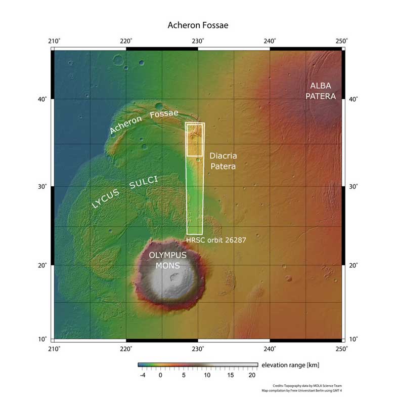
A broader look at the Acheron grooves. ESA
Combined with torsional stress caused by crustal movements, these volcanoes shaped this region at a time when Mars was a much more active planet than we see today. The trough-like features covering the right third of the image are known as “grabens”; they formed nearly four billion years ago when parallel crustal blocks were stretched and pulled apart. Long blocks shifted and collapsed, forming trenches, leaving behind taller blocks between them. The ridges stretch for approximately 800 km, nearly the length of Germany.
The smooth, unfolded patch in the lower center of the image marks the beginning of younger plains extending from the Acheron Basins. Closer to the grabens, traces of the movement of rock glaciers are visible on the plains (either rock fragments captured by flowing ice, or an ice flow covered in scree, or something in between). We see how these rock flows have moved away from the cliffs, forming gentle, sinuous lines reminiscent of waves breaking on the shore, culminating in rock piles gently descending from the cliffs (“debris aprons”).
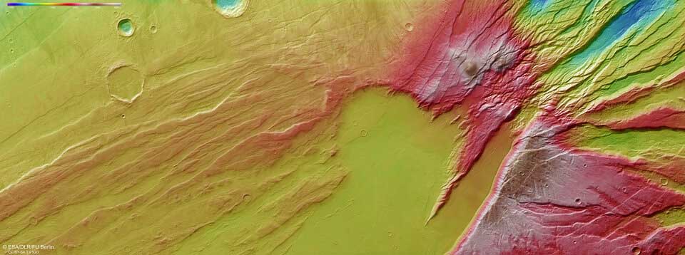
Topography of the Acheron Furrows – This color image shows the terrain’s elevation. ESA
The 3D perspective views below zoom in on some elements of the main image, including glacial flow features, grabens, and where grabens meet the smooth plain.

Further away from the cliffs, the smooth, even surface likely resulted from lava flowing from Mount Alba, which covered all existing features with a smooth layer of fresh rock. This same layer also covered the old impact crater, still visible as a semi-arc in the center of the frame (approximately 28 km in diameter).
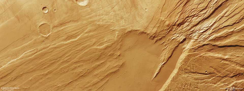
The Acheron Basins, as seen by the European Space Agency’s Mars Express spacecraft.
The aforementioned grabens cut through some of these domes, indicating that the crust here was fractured and deformed even after the domes formed.
Since its launch in 2003, the European Space Agency’s Mars Express spacecraft has imaged and explored numerous Martian landscapes. For more than two decades, the orbiter has mapped the planet’s surface with unprecedented resolution, in color and in three dimensions, providing data that has revolutionized our understanding of our neighboring planet.
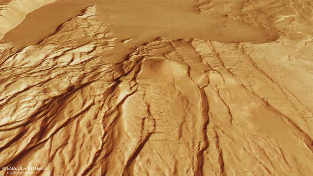
Landscape of Mars. ESA
The Mars Express High-Resolution Stereo Camera (HRSC) was developed and operated by the German Aerospace Center (DLR). Systematic processing of the camera’s data was conducted at the DLR Institute for Planetary Research in Berlin’s Adlershof district. The Planetary Science and Remote Sensing Working Group at the Free University of Berlin used this data to create the images presented here.
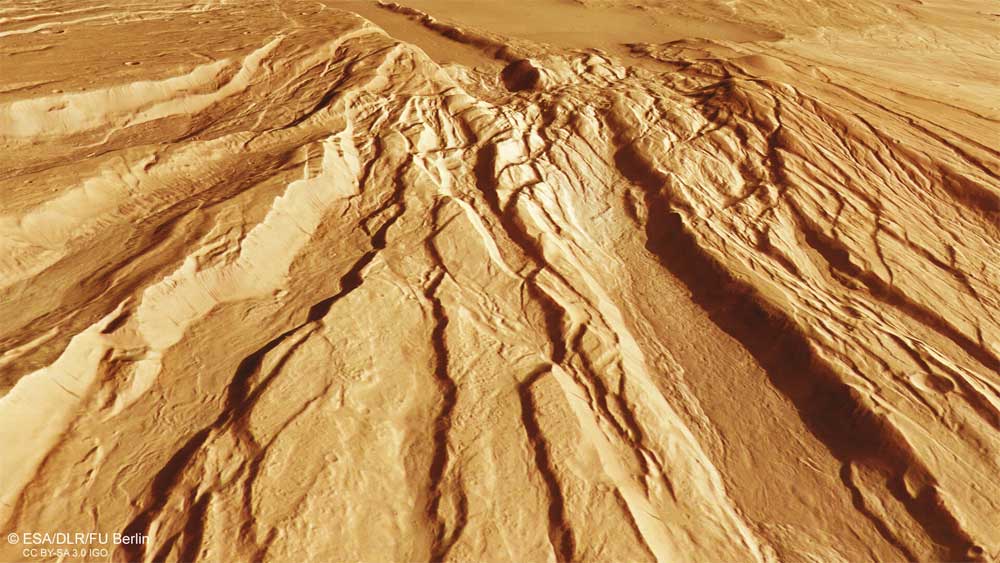
Landscape of Mars. ESA
Mars once harbored a lake larger than any other on Earth. The eroded and dried-up remains of this ancient lake are shown here in stunning detail, captured by the European Space Agency’s Mars Express spacecraft.
This region of Mars, captured in a new image by the High Resolution Stereo Camera (HRSC) on Mars Express, is known as Caralis Chaos. Scientists believe it once held abundant water, the European Space Agency (ESA) reported in July 2024.
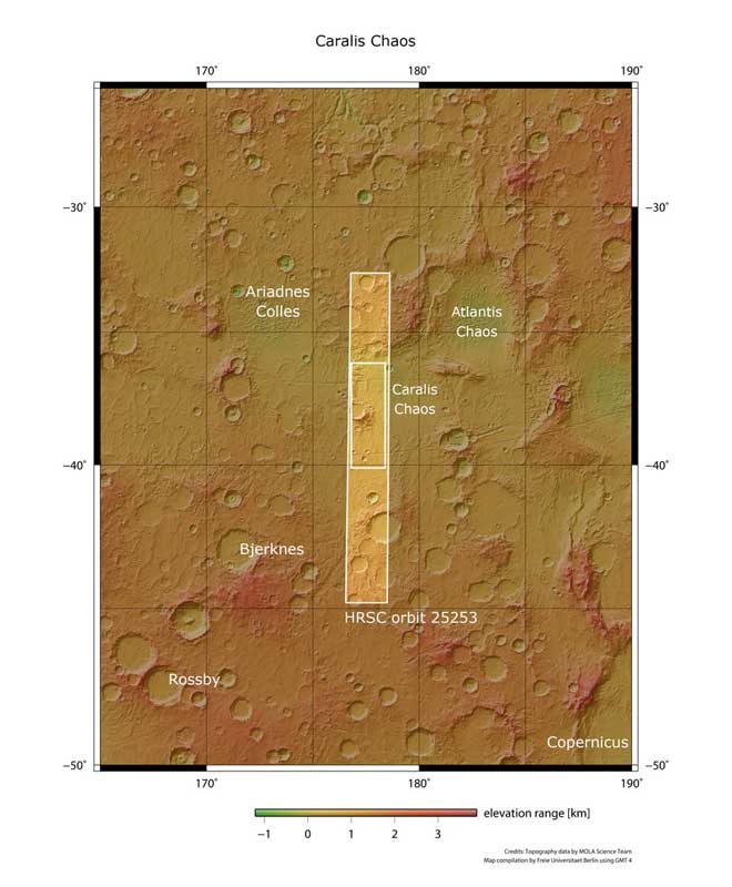
A broader look at the chaos of Karalis. ESA
The remains of an old lake bed are visible in the lower right of the frame (most clearly visible in the topographic image below, where it is shown in blue tones). The edges of this lake bed curve upward and extend from the lower center of the frame to the upper right, encircling the large central crater.
The old lake bed is now filled with numerous raised mounds, believed to have formed when ancient Martian winds blew dust across the planet; this dust was later covered and altered by water before drying out and crumbling again.
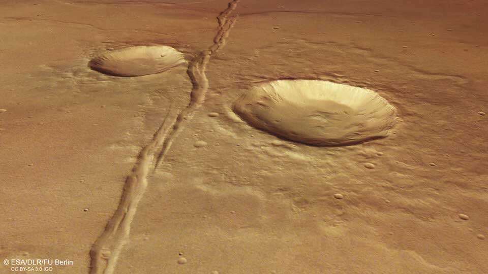
A perspective view of the landscape of Mars. ESA
In the wider region surrounding Karalis Chaos, there are several old lake basins that have eroded over time. Together, these basins form the remnants of a vast ancient lake that covered over a million square kilometers: Lake Eridania.
See also... New method for observing individual atoms confirms century-old quantum mechanical theory |
Lake Eridania once contained more water than all other Martian lakes combined and was larger than any known lake on Earth, holding enough water to fill the Caspian Sea nearly three times. It likely existed about 3.7 billion years ago, first as a single large body of water and then, as it dried out, as a series of smaller, isolated lakes. Eventually, this once-massive lake disappeared completely, like all other water on the planet.
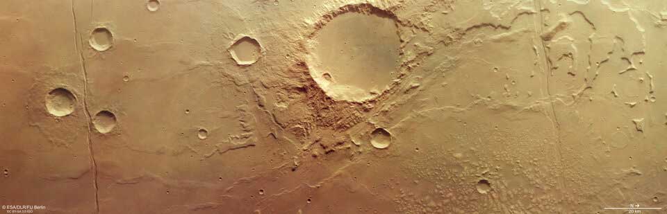
Karalis Chaos, imaged by the European Space Agency’s Mars Express. ESA
Besides water, there are clear signs of volcanic activity in and around the Karalis Chaos area.
In this image, two long cracks run vertically downwards, crossing both the aforementioned lakebed and the smoother surface to the left. These cracks, known as the Sirenum Fossa Fractures, were formed by the uplift of the Tharsis region of Mars, home to the largest volcanoes in the Solar System, placing enormous stress on the Martian crust.
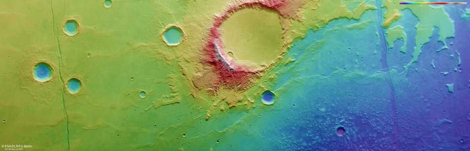
Topographical view of the landscape of Mars. ESA
Volcanic stress is also responsible for the numerous folds here. They appear as sinuous lines, intertwined horizontally across the frame. Folds are common on volcanic plains, formed when new lava layers are compressed while they are still soft and elastic, causing them to buckle and deform.
The impact craters formed by celestial bodies colliding with Mars are also fascinating. The large central crater shows evidence of material movement and valleys cut into its southern rim, suggesting that water may have persisted here even after Lake Eridania disappeared.
The smaller crater to the south is eroded by small gullies on its northern flank, while at the far right of the image are several ancient craters that can hardly be called craters, as they have been heavily eroded and eroded over time.
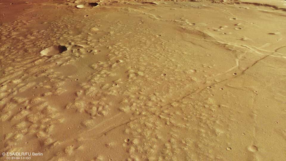
A perspective view of the landscape of Mars. ESA
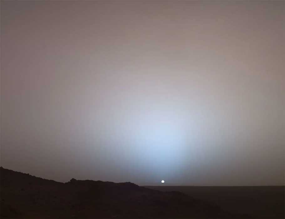
NASA’s Spirit rover captured this stunning view as the sun set over the rim of Gusev Crater on Mars 20 years ago. In this image, the bluish glow in the sky above the sun would be visible to us if we were there, but due to the infrared nature of the panoramic camera’s imaging, the redness of the sky further from sunset is exaggerated compared to the daytime colors of the Martian sky. NASA
See also... Complete list of HTML/Javascript event handlers with examples List of required documents for a website in the Russian Federation |